Model Output File
If configured to save any output data, model outputs are saved using the netCDF4 file format.
Gridded Variables
In any given run, the saving parameters “save_<var>_grids” control whether or not that 2-D grid variable (e.g. velocity) is saved to the netCDF4 file. In the netCDF4 file, a 3-D array with the dimensions time \(\times\) x \(\times\) y is created for each 2-D grid variable that is set to be saved. Note that x is the downstream coordinate, rather than the Cartesian x when displaying the grid. The appropriate units for all variables are stored: for example “meters per second” for the velocity grid.
Note
The format of the output netCDF file coordinate changed in v2.1.0. The
old format is documented
in legacy_netcdf, and that input
parameter legacy_netcdf can be used to create on output netcdf file with
the old coordinate configuration.
Grid Coordinates
Grid coordinates are specified in the variables time, x, and y in the output netCDF4 file. These arrays are 1D arrays, which specify the location of each cell in the domain in dimensional coordinates (e.g., meters). In the downstream direction, the distance of each cell from the inlet boundary is specified in x in meters. Similarly, the cross-domain distance is specified in y in meters. Lastly, the time variable is stored as a 1D array with model time in seconds.
Model Metadata
In addition to the grid coordinates, model metadata is saved as a group of 1-D arrays (vectors) and 0-D arrays (floats and integers). The values that are saved as metadata are the following:
Length of the land surface: L0
Width of the inlet channel: N0
Center of the domain: CTR
Length of cell faces: dx
Depth of inlet channel: h0
Sea level: H_SL
Bedload fraction: f_bedload
Sediment concentration: C0_percent
Characteristic Velocity: u0
If subsidence is enabled: - Subsidence start time: start_subsidence - Subsidence rate: sigma
Working with Model Outputs
The resulting netCDF4 output file can be read using any netCDF4-compatible library. These libraries range from the netCDF4 Python package itself, to higher-level libraries such as xarray. For deltas, and specifically pyDeltaRCM, there is also a package under development called DeltaMetrics, that is being designed to help post-process and analyze pyDeltaRCM outputs.
Here, we show how to read the output NetCDF file with Python package netCDF4.
import netCDF4 as nc

data = nc.Dataset('pyDeltaRCM_output.nc')  # the output file path!
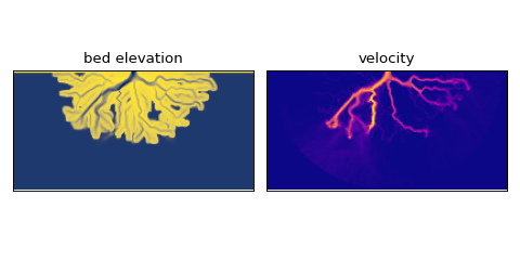
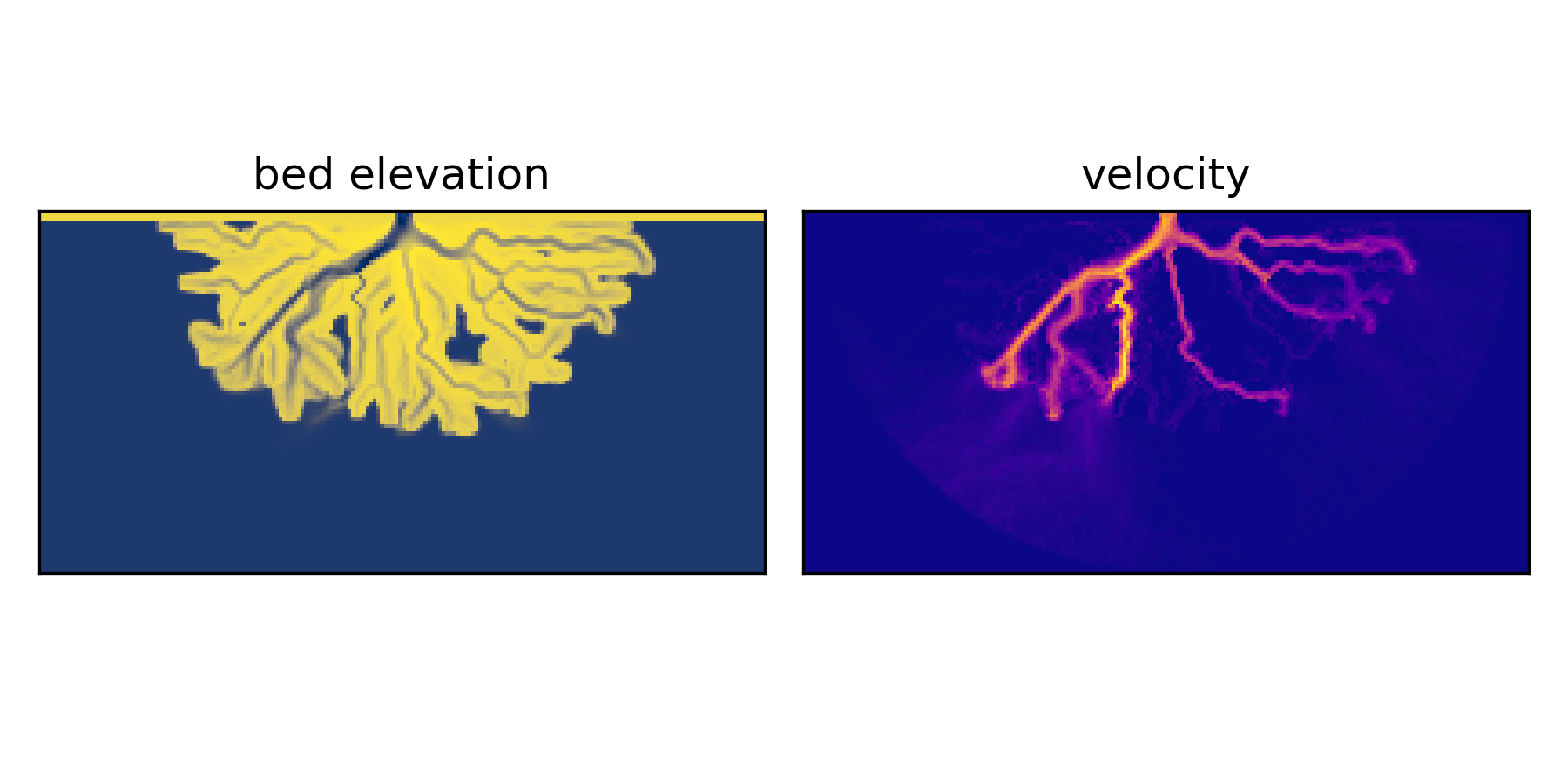
This data object is a Dataset object that can be sliced the same was as a numpy array. For example, we can slice the final bed elevation and velocity of a model run:
final_bed_elevation = data['eta'][-1, :, :]
final_velocity = data['velocity'][-1, :, :]
These slices look like this, if we were to plot them.