deltametrics.plan.compute_shoreline_roughness
- deltametrics.plan.compute_shoreline_roughness(shore_mask, land_mask, **kwargs)
Compute shoreline roughness.
Computes the shoreline roughness metric:
\[L_{shore} / \sqrt{A_{land}}\]given binary masks of the shoreline and land area. The length of the shoreline is computed internally with
compute_shoreline_length.- Parameters:
shore_mask (
ShorelineMask,ndarray) – Shoreline mask. Can be aShorelineMaskobject, or a binarized array.land_mask (
LandMask,ndarray) – Land mask. Can be aLandMaskobject, or a binarized array.**kwargs – Keyword argument are passed to
compute_shoreline_lengthinternally.
- Returns:
roughness – Shoreline roughness, computed as described above.
- Return type:
float
Examples
Compare the roughness of the shoreline early in the model simulation with the roughness later. Here, we use the elevation_offset parameter (passed to
ElevationMask) to better capture the topography of the pyDeltaRCM model results.golf = dm.sample_data.golf() # early in model run lm0 = dm.mask.LandMask( golf['eta'][15, :, :], elevation_threshold=0, elevation_offset=-0.5) sm0 = dm.mask.ShorelineMask( golf['eta'][15, :, :], elevation_threshold=0, elevation_offset=-0.5) # late in model run lm1 = dm.mask.LandMask( golf['eta'][-1, :, :], elevation_threshold=0, elevation_offset=-0.5) sm1 = dm.mask.ShorelineMask( golf['eta'][-1, :, :], elevation_threshold=0, elevation_offset=-0.5)
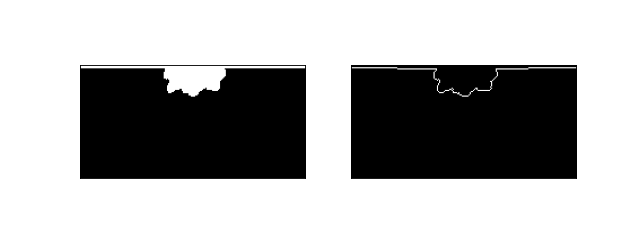
Let’s take a quick peek at the masks that we have created.
fig, ax = plt.subplots(1, 2, figsize=(8, 3))
lm0.show(ax=ax[0])
sm0.show(ax=ax[1])
plt.show()
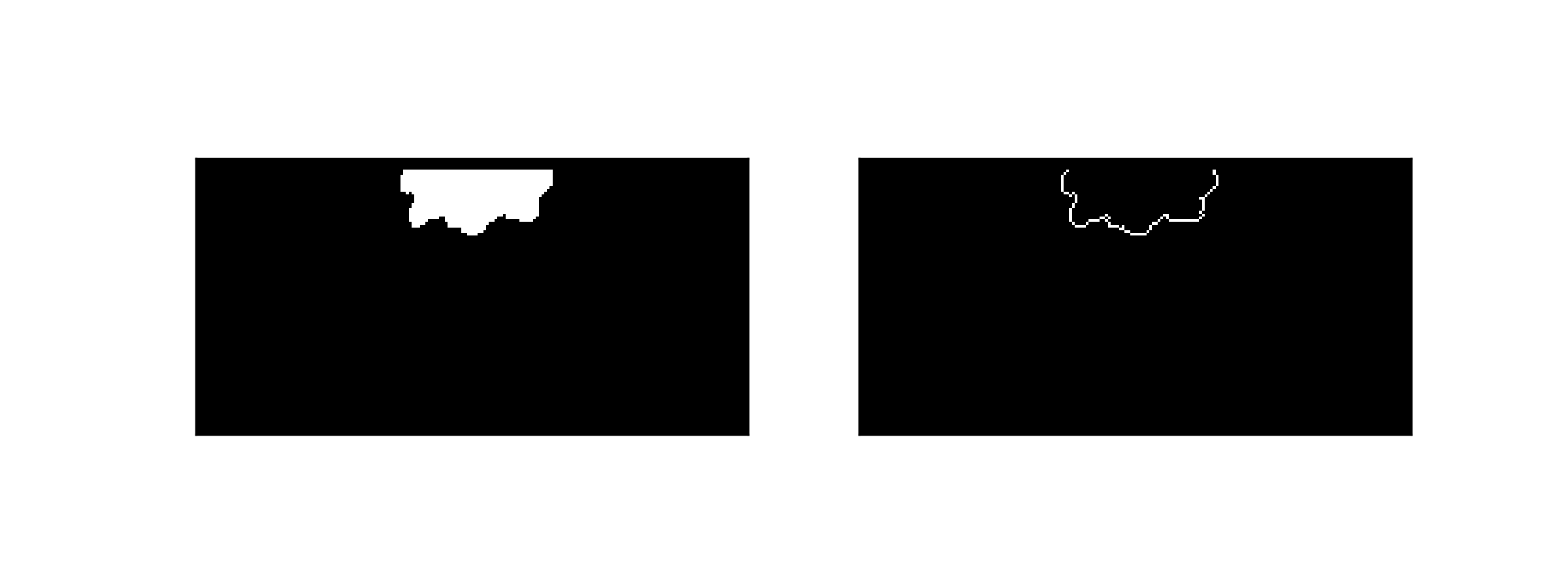
In order for these masks to work as expected in the shoreline roughness computation, we need to modify the mask values slightly, to remove the land-water boundary that is not really a part of the delta. We use the
trim_mask()method to trim a mask.lm0.trim_mask(length=golf.meta['L0'].data+1) sm0.trim_mask(length=golf.meta['L0'].data+1) lm1.trim_mask(length=golf.meta['L0'].data+1) sm1.trim_mask(length=golf.meta['L0'].data+1) fig, ax = plt.subplots(1, 2, figsize=(8, 3)) lm0.show(ax=ax[0]) sm0.show(ax=ax[1]) plt.show()

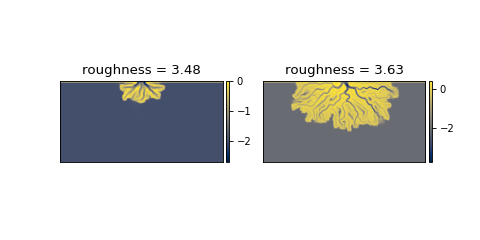
And now, we can proceed with the calculation.
# compute roughnesses
rgh0 = dm.plan.compute_shoreline_roughness(sm0, lm0)
rgh1 = dm.plan.compute_shoreline_roughness(sm1, lm1)

# make the plot
fig, ax = plt.subplots(1, 2, figsize=(6, 3))
golf.quick_show('eta', idx=15, ax=ax[0])
ax[0].set_title('roughness = {:.2f}'.format(rgh0))
golf.quick_show('eta', idx=-1, ax=ax[1])
ax[1].set_title('roughness = {:.2f}'.format(rgh1))
plt.show()